Swell Generation and Propagation Basics
By Drstuess on 12/14/2023
Swell Generation and Propagation Basics
While Playbuoy makes buoy data as accessible as possible, having a better understanding of waves and the more advanced data available from buoys helps better inform whatever water activity you are doing. This basic blog will start a string of short blogs with the aim of helping people get the most out of the buoys.
As a simplification, the lifecycle of a swell seen on the buoy can be broken up into three phases.
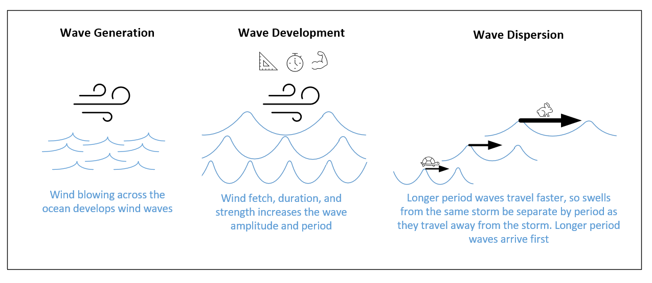
Wave Generation- Wind transfers energy to the ocean surface, creating ripples (capillary waves) that further develop into wind waves. Large waves are not seen on an observing buoy during this early stage, although some buoys will report the wind. Wave Development- As wind continues to blow over wind waves, more energy is imparted and the height and distance (and time) between individual waves increases. The energy imparted is driven by 3 main factors: wind speed (stronger wind = bigger waves), fetch (larger area of wind pointed in one direction = bigger waves), and duration (longer the wind blows = bigger waves). When the waves are developing, there is often a greater mixture of wave heights and wavelengths seen on a buoy, and the waves are generally steeper and choppy.
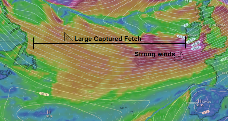 Favorable setup with strong winds and large area of fetch creating significant swell for Europe.
Wave Dispersion- When the waves are generated, they begin to propagate away from the storm. Waves of different wavelength and period travel at different speeds, and therefore natural group with other waves of similar period/wavelength. Over time and distance, these wave groups separate from other groups of different periods and speeds. Along with separating, these propagating wave groups attenuate (get smaller) and refract (shift direction).
Two take-aways or generalizations can be draw from this:
- For swells generated far from you and in the Wave Dispersion regime above (think ground swell), the period will start highest and reduce over time. This is because the longer period swells travel faster and arrive first, then the lower period swells arrive later.
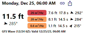
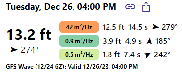
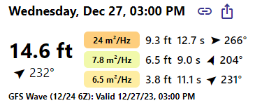
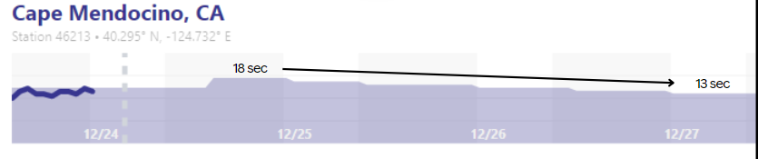 GFS Forecast for Cape Mendocino buoy shows swell period decreasing from ~18 seconds to ~13 seconds over 3 days from December 25th to 27th.
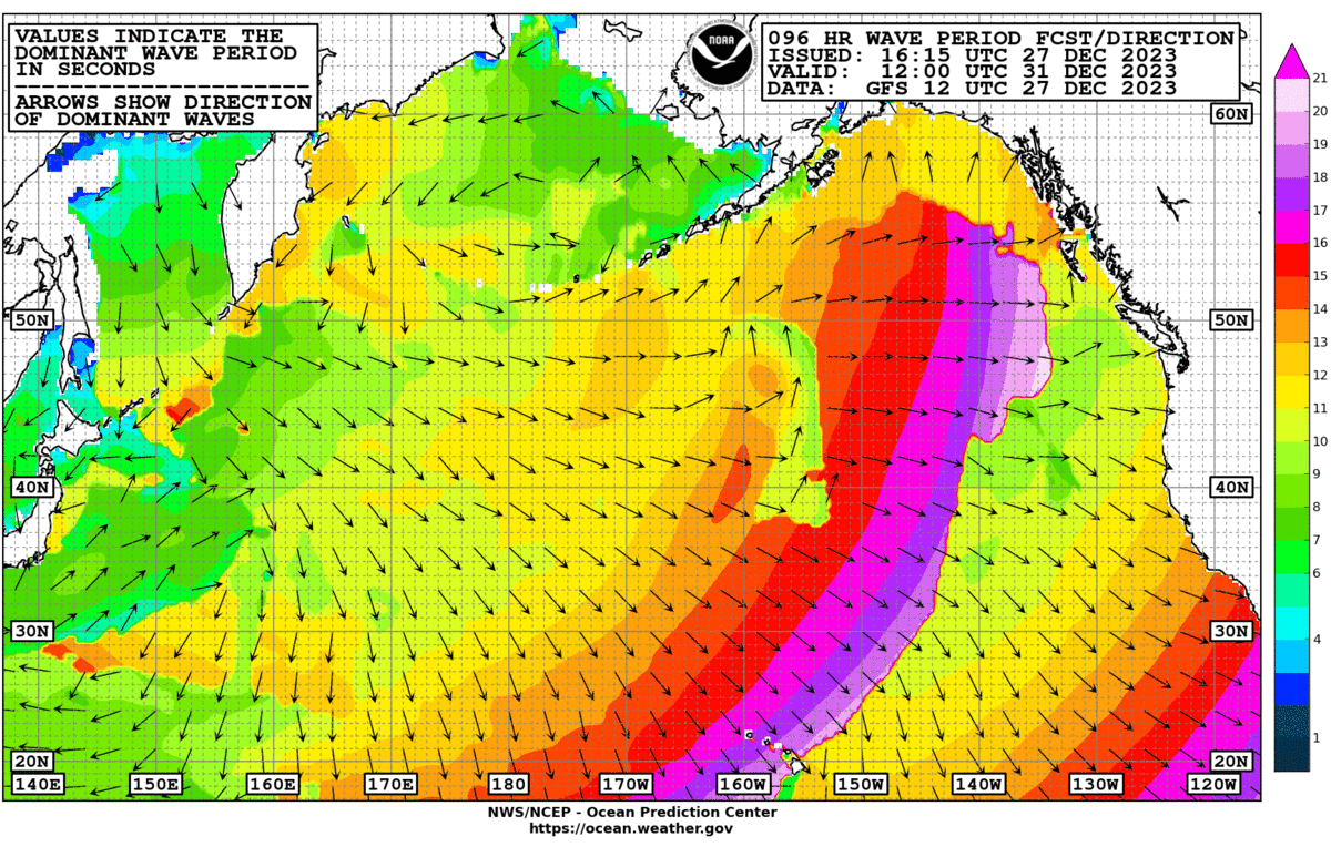
Looking at the whole pacific basin, you can see this clearly in a dominant wave period map from NWS OPC.
- For swells or waves generated when the storm or winds are close to where you surf (think local windswells), the period will increase over time as the imparted energy in the waves increases.
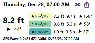
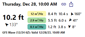 GFS Forecast for Nantucket buoy shows swell period increasing from ~8.5 to ~10.5 seconds as imparted energy increases in the sea state and more energetic swells are generated.
Note, both these phenomena can be observed in a single swell event. There can be a local windswell phase from the local winds (where the period and energy increase), then there can be a groundswell/leftovers phase as swells generated when the storm is more remote arrive.
Be on the lookout for more blogs that will be posted and reach out if there is something that interests you!