Seeing the Spread: GEFS Ensemble Forecasts
By mattnucc on 3/31/2026
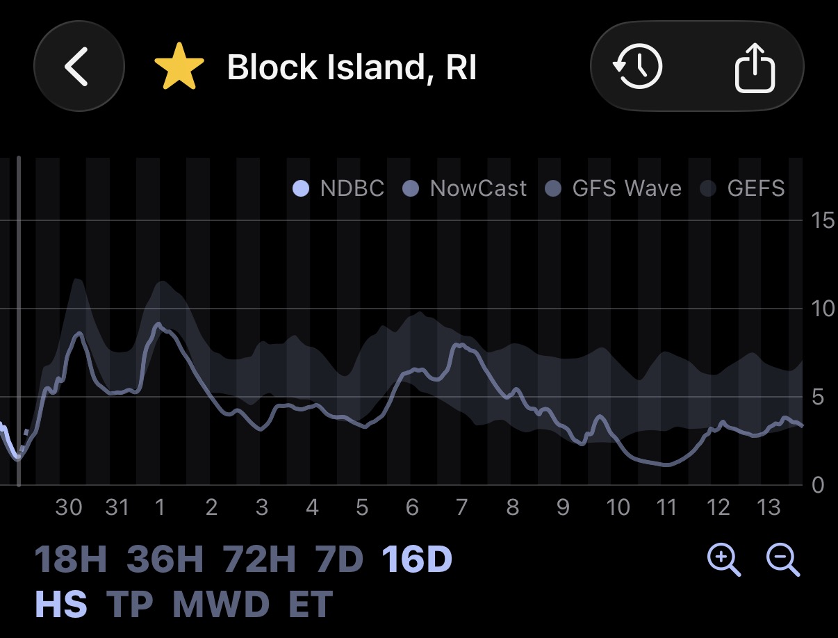
Playbuoy will now show the ensemble spread envelope for wave height and period where data is available from NOAA’s GEFS Wave Model!
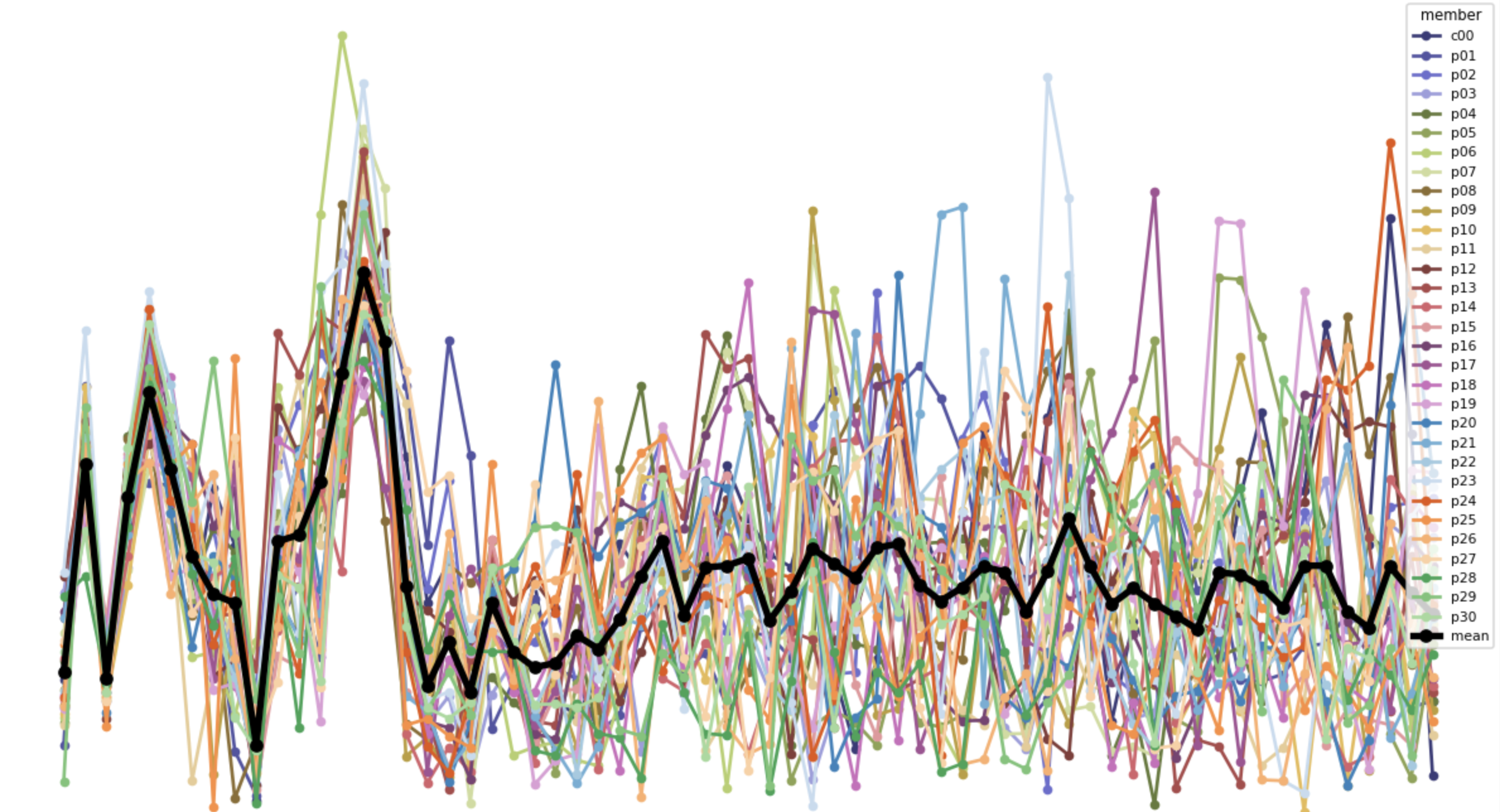
As covered in Using Wave Models, wave models are initialized with imperfect observations of a chaotic system. The standard operational run is a single "best guess" — but the atmosphere and ocean don't always cooperate. An ensemble runs the same model many times with slightly different starting conditions to map out the range of plausible outcomes. Each member's outcomes diverge slightly from the others, creating a "spread" of possible outcomes over time.
This becomes a useful signal for how to use a forecast to plan or set expectations. A tight ensemble spread means less uncertainty across the varied initial conditions and high confidence in the forecast. A wider spread show uncertainty in the forecast: maybe its a marginal swell that may or may not show, or that a storm's track is still up in the air. This is especially relevant for long-range windows (think beyond 5 days in the future), or locally generated wind swell and storm fronts that are harder to pin down than propagating groundswell. If you have ever noticed and been frustrated by swells disappearing and re-appearing in the forecast from run to run, visibility to the ensembles can complement with a more probabilistic and often less flaky view of the forecast.
Spread indicates how far apart the ensemble members are from each other. Its the population standard deviation across ensemble members (GEFS has 30 members):
SPRD = √[ (1/n) · Σⱼ (f̄ − fⱼ)² ]
Where n is the number of ensemble members (30 for GEFS) and f̄ is the ensemble mean. This is computed independently at each forecast time step.
The ensemble spread is shown in the app as a shaded band around the operational forecast for wave height and wave period. Wider band = more uncertainty. Use it as a confidence check or a source of hopium, not a replacement for the operational run.
Try it out at playbuoy.app and let us know what you think.